Natural sights
27 results Sort :
The Vogelsteine lava flow dates from the volcanic period of the Vosges mountains, 330million year ago. At that time the surface was covered by a low water sea and islands.
Both of the Neuweiher lakes are the result of glacier activity. Throughout their history, the lakes were drained and used as a meadow. Then the dikes were built again for the needs...
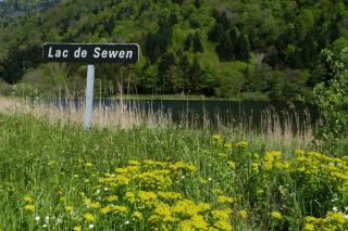
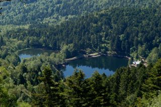
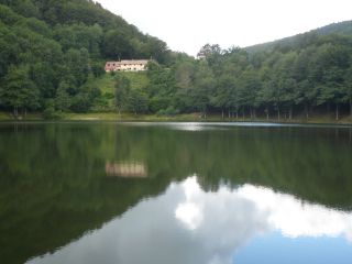
Sewen Lake is characteristic of the ancient glacial valleys. The lake is actually transforming into marshland. Beavers were reintroduced here recently in their natural habitat.

The path of the three lakes is situated nearby Gresson and Haute-Bers rigdges and runs past the Neuweiher lake and the Perches lake.
The Lachtelweiher is the most southern lake of the Vosges. According to geologists the rocks that form the natural dam of the lake came from a landslide.
According to a legend, ...
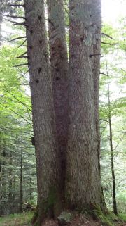
The legend tells that four brave men, wich fought in the Thirty Years War, died after being tied at the bottom of this fir. It was cut at man's height and grew in four branches ...
The Lake Perches, also called Sternsee (lake of the stars), is located in an old glacial cirque at 1000 meters altitude. Its name isn't due to the fish of the same name but to ...
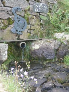
The Doller source is situated at a heigth of 922m. The first catchment of water was in 1906. Since then, the water supplies the city of Mulhouse and its surroundings.
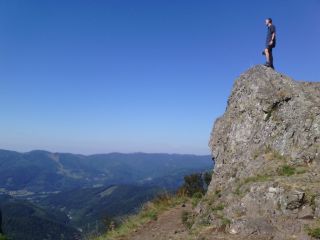
This summit on a height of 1042m has a round top, wich is caracteristic for the summits of the Vosges. (Ballons des Vosges). The word comes originally from the prefix "b...