Gite du Gazon vert - gite du Belacker
Legend :
Auberge du Gazon Vert-gîte d'étape
Auberge du Belacker
Caracteristics
Difficulty ratingEasy
Distance (in km) 6.5
Elevation gain + (in m) 309
Elevation loss - (in m) 274
Length (3.5 km/h) 1h50
along the way Book
Book


 Book
Book

GPS data - 47.85219,6.92745
An exceptional natural site
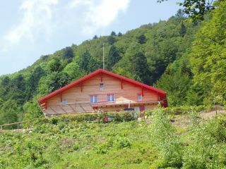
The Gazon Vert lodge is situated at 928m in a greenery surrounding. The traditional construction has been preserved as well as the view from above over the Storckensohn valley. Gazon Vert is different from the other lodges of the H...
The Gazon Vert lodge is situated at 928m in a greenery surrounding. The traditional construction has been preserved as well as the view from above over the Storckensohn valley. Gazon Vert is different from the other lodges of the H...

GPS data - 47.84626,6.92312
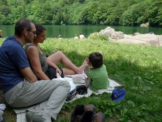
The Lake Perches, also called Sternsee (lake of the stars), is located in an old glacial cirque at 1000 meters altitude. Its name isn't due to the fish of the same name but to a transmission error. It should have been called “Bers”, the name of a pasture nearb
...
GPS data - 47.83732,6.99006
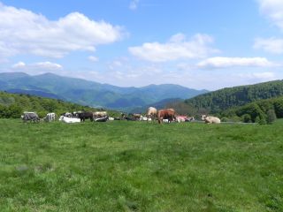
The Belacker pasture (chaume) is located between the Rossberg and the Vogelstein. These high mountain pastures are typically for the southern Vosges mountains. Their were first mentionned in 1550. Cattle appreciate juicy grass and gentle slopes. Hikers pause a...

GPS data - 47.83801,6.99076
Amid the high pastures
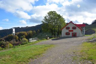
In the vicinity of Vogelstein, rocky headlands located at 1 181m above sea reveal the Belacker Inn. The terrace of the establishment offers a view of the valley of Saint-Amarin and of the highest peaks of the Massif des Vosges, the Gra...
In the vicinity of Vogelstein, rocky headlands located at 1 181m above sea reveal the Belacker Inn. The terrace of the establishment offers a view of the valley of Saint-Amarin and of the highest peaks of the Massif des Vosges, the Gra...
