En passant par l'Alsace
Stages
OT St-Maurice s/ Moselle - Auberge du Gustiberg
Auberge du Gustiberg
Gite de la ferme du Bergenbach
Auberge du Gustiberg
Caracteristics
Difficulty ratingEasy
Distance (in km) 43,8
Elevation gain + (in m) 1782
Elevation loss - (in m) 1777
Length in Days (3.5 km/h) 4
Length in Days/Nights (3.5 km/h) 3
Length (3.5 km/h) - hiking on a 3 days tour: 3
along the way


Day Nr. 1

GPS data - 47.89331,6.92850
A breathtaking panorama
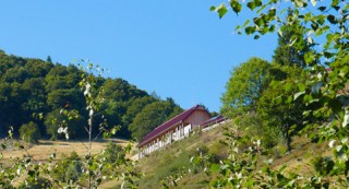
L'Auberge du Gustiberg is situated on a height of 980m and offers a great view of the Thur valley and the Bussang mountain pass, the natural border between Alsace and Lorraine. It is also a good spot for paragliding.
An institution
...
L'Auberge du Gustiberg is situated on a height of 980m and offers a great view of the Thur valley and the Bussang mountain pass, the natural border between Alsace and Lorraine. It is also a good spot for paragliding.
An institution
...
Day Nr. 2
GPS data - ,

GPS data - 47.91188,6.95456
A breathtaking view
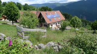
The Bergenbach farmer's lodge is located on the western flank of the Thur valley at 800 m altitude. The lodge offers a view of the Vosges peaks and the village of Fellering Oderen in the valley.
Since 1978
Jacques Simon and Marlene K...
The Bergenbach farmer's lodge is located on the western flank of the Thur valley at 800 m altitude. The lodge offers a view of the Vosges peaks and the village of Fellering Oderen in the valley.
Since 1978
Jacques Simon and Marlene K...
Day Nr. 3
GPS data - ,

GPS data - 47.89331,6.92850
A breathtaking panorama
L'Auberge du Gustiberg is situated on a height of 980m and offers a great view of the Thur valley and the Bussang mountain pass, the natural border between Alsace and Lorraine. It is also a good spot for paragliding.
An institution
...
L'Auberge du Gustiberg is situated on a height of 980m and offers a great view of the Thur valley and the Bussang mountain pass, the natural border between Alsace and Lorraine. It is also a good spot for paragliding.
An institution
...
Day Nr. 4
