Les Giromagniers
Difficulty ratingModerate
Distance (in km) 36.2
Elevation gain + (in m) 1501
Elevation loss - (in m) 1503
Length in Days (3.5 km/h) 3
Length in Days/Nights (3.5 km/h) 2
Length (3.5 km/h) - hiking on a 3 days tour: 3h30
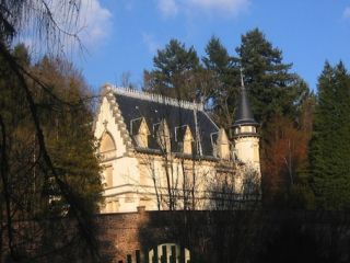
This castle was built in 1900 by the architect Constant Tisserand, in neogothic style and using ferroconcrete as building material. It belonged to the family until 1947, it was then bought by the city of Belfort. Today a childrens summer camp is housed in the
...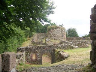
The castle (Château du Rosemont) is located on the slopes of the Ballon d'Alsace and was apparently built by Louis de Mousson, Count of Montbéliard. The remains consist of a square tower in the east with two or three floors, and 1.50 m thick walls as well as t
...
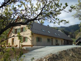
On the sunny side
The Graber hostel is located on the southern side of the Masevaux valley, nearby the Doller source.The Bittel familiy took over the lodge to preserve local traditions.
The architecture is an example of farms from the late 19th century. Th
...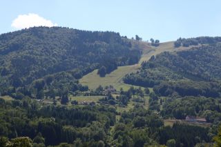
The Schlumpf ski resort at Dolleren, is located between 675m and 1012m altitude and has three slopes:
- La Verdure, a red slope with an average gradient of 30%
- La Dolleroise, a green slope
- A toboggan run
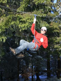
At the Ballon d'Alsace, the Acrobranch Park offers 12 different obstacle courses: monkey bridges, Tarzan lianas ... The Acro-ball is the highlight of the adventure park. It is a giant inflatable ball that rolls down the slopes in the grass or in the snow.
...
Located 1247m above sea level, the Ballon d'Alsace offers in summer: hiking, biking, the so called Cani-rando (accompanied by a dog), paragliding, climbing trees (acrobranch)
In winter it is one of the largest ski resorts of the Vosges and a snow park, more
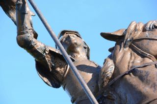
The Ballon d'Alsace Ballon extends over the regions of Lorraine, Franche-Comte and Alsace. The Ballon d'Alsace is located in the Regional Natural Park of Ballons des Vosges as well as in the the nature reserve of the Ballons Comtois. For over 30 years this pea
...
Overlooking the Doller
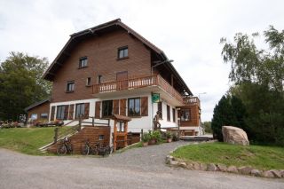
The inn of Langenberg is on the Alsatian side of the Ballon d'Alsace, nearby Franche-Comté (Belfort is at 30 km) and the Lorraine Region (Remiremont is at 40km). The place offers a panoramic view over the Vallée de Masevaux and Sewen.

The Ballon d'Alsace Ballon extends over the regions of Lorraine, Franche-Comte and Alsace. The Ballon d'Alsace is located in the Regional Natural Park of Ballons des Vosges as well as in the the nature reserve of the Ballons Comtois. For over 30 years this pea
...
Located 1247m above sea level, the Ballon d'Alsace offers in summer: hiking, biking, the so called Cani-rando (accompanied by a dog), paragliding, climbing trees (acrobranch)
In winter it is one of the largest ski resorts of the Vosges and a snow park, more
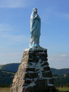
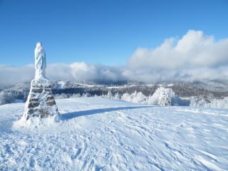
The Virgin of Wissgrut stands on the slopes of the Ballon d'Alsace. It was built in 1946 by Xavier Berna, a farmer from Wissgrut after returning from deportation in Germany.

This castle was built in 1900 by the architect Constant Tisserand, in neogothic style and using ferroconcrete as building material. It belonged to the family until 1947, it was then bought by the city of Belfort. Today a childrens summer camp is housed in the
...